Northern Japanese Alps Trek

About the Murodō to Kamikōchi Northern Japanese Alps Trek

The Northern Japanese Alps Trek from Murodō to Kamikōchi is a 65 km journey that spans seven days, offering an unforgettable adventure through one of Japan’s most scenic mountain ranges. This trek traverses rugged terrains, high-altitude ridges, and alpine meadows, making it a favorite among seasoned hikers. Along the way, you’ll encounter breathtaking vistas of snow-capped peaks, serene mountain lakes, and vibrant flora. Each day brings new challenges and stunning landscapes, promising a truly immersive outdoor experience. You can see our outdoor maps page to find all the specific maps of Japan.

Starting at Murodō, known for its impressive alpine environment and hot springs, the trek concludes in Kamikōchi, a beautiful highland valley celebrated for its pristine natural beauty. As you progress, you’ll pass through lush forests, cross rocky passes, and ascend towering peaks. The route offers panoramic views of iconic mountains such as Mount Tateyama and Mount Hotaka, ensuring that every step is filled with awe-inspiring sights.

Key points of interest include the dramatic Tateyama Mountain Range, the serene Kurobe Dam, and the tranquil Myojin Pond. Outonome.com enhances your trekking experience by providing detailed itineraries, interactive planning tools, and downloadable GPX tracks. Whether you need to calculate hiking times, find accommodations, or navigate the trails, our platform equips you with everything necessary for a successful trek through the Northern Japanese Alps.

icon-distance

65.25 km

icon-difficulty

Hard

icon-distance

~7 days

icon-distance

3154 m

icon-distance

6567 m

icon-distance

7464 m

Country crossed : Japan

Northern Japanese Alps Trek steps

How to use the outonome.com tabloguide ?

Doing the Northern Japanese Alps Trek in the reverse way

You can change the direction of the itinerary by pressing the “Normal way” button. The Northern Japanese Alps Trek will switch from the classic way to the reverse way.

Trail or hike the Murodō to Kamikōchi Northern Japanese Alps Trek

You can press the button on the hiking boot to switch to trail mode, this will automatically change the steps times.

Adapt the Murodō to Kamikōchi Northern Japanese Alps Trek steps to your physical condition

You can select your physical condition from 5 choices to have step times automatically recalculated so you can better prepare your itinerary or steps.

Calculate walking times between two steps

In the tabloguide, to the left of each step is a greyed-out circle, simply click on the 2-steps circles to have the path time calculated according to the data you’ve selected (hike/trail and physical condition) as well as distance, time, altitude difference, etc….

View a step on the map

By clicking on the map dot icon to the left of a step name, the site scrolls down to where the map is and zooms in on the exact location of the step.

See off-trail and variants of the Northern Japanese Alps Trek

On some steps, to the right of the name, there are blue squares (variants, which momentarily take another path and then join it) or yellow squares (off-trails, which go completely off the itinerary). These squares are clickable and open the linked steps.

Get information on each step of the Northern Japanese Alps Trek

For each step are shown estimated walking times (according to the parameters selected), the distance between the previous step and this one, the positive and negative vertical drop, and the minimum and maximum altitudes reached during the step.

Locate refuges, bivouacs, hotels, supermarkets, restaurants, buses on each Murodō to Kamikōchi Northern Japanese Alps Trek step

On each step line, on the right-hand side of the tabloguide, you’ll find: bivouacs, refuges, hotels, guesthouses, supermarkets, restaurants, cafés, buses, trains. If one of these is located at the step, there is a tick, otherwise there is nothing.

What's your physical condition ?
Step
Time
Distance
Altitude
D+
D-
Alti+
Alti-
Camping / Bivouac
Basic shelter / Unguarded refuge
Alpin hut / Guarded refuge
Guest-house
Hotel
Supply / Supermarker
Restaurant
Cafe
Bus
flag-JAPAN
Murodō (室堂)
S
00h00
0
2432
0
0
2432
2432
flag-JAPAN
Murodō (室堂)
00h00
0
2432
0
0
2432
2432
flag-JAPAN
Ichinokoshi Hut (一の越山荘)
K
01h10
1.99
2671
263
24
2680
2432
flag-JAPAN
Mikurigaike Pond (ミクリガ池)
R
00h10
0.58
2411
3
24
2434
2411
flag-JAPAN
Mikurigaike Pond (ミクリガ池)
00h00
0
2411
0
0
2411
2411
flag-JAPAN
Raichoso
00h15
0.86
2370
18
58
2410
2365
flag-JAPAN
Raichozawa Hutte (雷鳥沢ヒュッテ)
00h05
0.35
2319
1
52
2370
2319
flag-JAPAN
Lodge Tateyama Renpō (ロッジ立山連峰)
00h25
0.94
2305
30
136
2411
2305
flag-JAPAN
Raichozawa Hutte (雷鳥沢ヒュッテ)
00h05
0.07
2319
14
0
2319
2313
flag-JAPAN
Raichosawa Camping Ground (雷鳥沢キャンプ場)
00h05
0.3
2282
0
38
2309
2281
flag-JAPAN
Intersection
G
C
B
00h00
0.14
2271
0
11
2276
2271
flag-JAPAN
Intersection
C
B
00h00
0
2271
0
0
2271
2271
flag-JAPAN
Tsurugigozen Hut (剱御前小舎)
01h45
1.79
2731
494
33
2731
2269
flag-JAPAN
Mount Tsurugi Gozen (剱御前)
00h20
0.75
2740
49
41
2761
2732
flag-JAPAN
Tsurugigozen Hut (剱御前小舎)
00h20
0.75
2731
41
49
2761
2731
flag-JAPAN
Intersection
C
B
00h50
1.79
2271
33
494
2727
2269
flag-JAPAN
Intersection
B
00h00
0
2271
0
0
2271
2271
flag-JAPAN
Tsurugigozen Hut (剱御前小舎)
01h45
1.79
2731
494
33
2731
2269
flag-JAPAN
Tsurugisawa Camping Ground (劔沢キャンプサイト)
00h35
1.18
2519
40
253
2767
2519
flag-JAPAN
Tsurugisawa Hut (剱沢小屋)
00h05
0.13
2488
0
31
2511
2488
flag-JAPAN
Tsurugisawa Camping Ground (劔沢キャンプサイト)
00h05
0.13
2519
31
0
2519
2491
flag-JAPAN
Tsurugigozen Hut (剱御前小舎)
01h00
1.18
2731
253
40
2767
2526
flag-JAPAN
Intersection
B
00h50
1.79
2271
33
494
2727
2269
flag-JAPAN
Intersection
00h00
0
2271
0
0
2271
2271
flag-JAPAN
Tsurugigozen Hut (剱御前小舎)
01h45
1.79
2731
494
33
2731
2269
flag-JAPAN
Mount Bessan (別山)
00h30
0.79
2815
119
35
2815
2711
flag-JAPAN
Mount Masago (真砂岳)
00h45
1.22
2838
149
126
2841
2707
flag-JAPAN
Intersection
D
H
00h10
0.44
2787
4
56
2839
2787
flag-JAPAN
Intersection
D
H
01h55
2.01
2787
540
24
2800
2270
flag-JAPAN
Intersection
H
00h00
0
2787
0
0
2787
2787
flag-JAPAN
Kuranosuke Hut (内蔵助山荘)
00h20
0.75
2767
56
76
2839
2767
flag-JAPAN
Intersection
L
01h45
4.03
1705
36
1098
2761
1705
flag-JAPAN
Intersection
00h00
0
1705
0
0
1705
1705
flag-JAPAN
Masagozawa Lodge (真砂沢ロッジ)
02h10
3.54
1779
422
348
2033
1704
flag-JAPAN
Intersection
02h00
3.54
1705
348
422
2033
1704
flag-JAPAN
Kurobe Dam (黒部ダム)
03h45
5.46
1428
704
981
1726
1257
flag-JAPAN
Kurobeko Station (黒部湖駅)
00h10
0.5
1464
37
1
1464
1427
flag-JAPAN
Lodge Kuroyon (ロッジくろよん)
00h45
1.35
1447
127
145
1510
1429
flag-JAPAN
Ichinokoshi Hut (一の越山荘)
K
05h00
6.19
2671
1348
124
2671
1451
flag-JAPAN
Intersection
00h00
0
2787
0
0
2787
2787
flag-JAPAN
Kuranosuke Hut (内蔵助山荘)
00h20
0.75
2767
56
76
2839
2767
flag-JAPAN
Intersection
00h25
0.75
2787
76
56
2839
2771
flag-JAPAN
Fuji-no-oritate (富士ノ折立)
00h40
0.55
2970
193
9
2972
2780
flag-JAPAN
Mount Onanji (大汝山)
00h10
0.36
2967
17
20
2985
2966
flag-JAPAN
Oyama Shrine Peak Sanctuary (雄山神社 峰本社)
00h15
0.49
2918
25
74
2968
2918
flag-JAPAN
Ichinokoshi Hut (一の越山荘)
K
00h20
0.62
2671
1
247
2915
2671
flag-JAPAN
Ichinokoshi Hut (一の越山荘)
00h00
0
2671
0
0
2671
2671
flag-JAPAN
Lodge Kuroyon (ロッジくろよん)
02h40
6.19
1447
124
1348
2671
1447
flag-JAPAN
Lake Kurobe (黒部湖)
01h55
3.61
1489
339
297
1547
1436
flag-JAPAN
Hirano Koya (平乃小屋)
01h55
3.38
1431
327
385
1532
1427
flag-JAPAN
Kariyasutōge (刈安峠)
01h35
2.24
1829
419
21
1829
1428
flag-JAPAN
Goshimagahara Sanso (五色ヶ原山荘)
02h35
3.39
2476
689
42
2476
1832
flag-JAPAN
Mount Shishidake (獅子岳)
01h45
2.66
2666
340
345
2816
2575
flag-JAPAN
Goshimagahara Sanso (五色ヶ原山荘)
01h15
2.51
2476
165
355
2665
2335
flag-JAPAN
Mount Tombi (鳶山)
00h30
1.04
2570
106
11
2580
2477
flag-JAPAN
Mount Etchuzawa (越中沢岳)
01h20
2.4
2528
225
267
2558
2334
flag-JAPAN
Sugonokkoshi Goya (スゴ乗越小屋)
01h50
2.66
2265
309
572
2532
2122
flag-JAPAN
Mount Mayama (間山)
01h15
1.49
2550
334
50
2550
2262
flag-JAPAN
Mount Yakushi (薬師岳)
02h00
3.08
2898
456
107
2898
2557
flag-JAPAN
Yakushidake Sanso (薬師岳山荘)
00h30
1.24
2677
14
235
2898
2670
flag-JAPAN
Tarodaira Camping Ground (太郎平キャンプ場)
00h40
1.7
2279
7
404
2676
2279
flag-JAPAN
Tarodaira Goya (太郎平小屋)
A
S
00h25
0.92
2312
69
35
2322
2278
flag-JAPAN
Tarodaira Goya (太郎平小屋)
S
00h00
0
2312
0
0
2312
2312
flag-JAPAN
Oritate Camping Ground (折立ヒュッテ)
02h20
6.23
1370
84
1026
2329
1370
flag-JAPAN
Lake Arimine (有峰湖)
02h30
5.34
1104
334
600
1428
1104
flag-JAPAN
Oritate Camping Ground (折立ヒュッテ)
03h00
5.34
1370
600
334
1428
1109
flag-JAPAN
Tarodaira Goya (太郎平小屋)
S
04h10
6.23
2312
1026
84
2329
1377
flag-JAPAN
Tarodaira Goya (太郎平小屋)
00h00
0
2312
0
0
2312
2312
flag-JAPAN
Yakushizawa Hut (薬師沢小屋)
01h55
4.68
1953
186
545
2346
1941
flag-JAPAN
Kumonodaira Hut (雲ノ平山荘)
S
02h30
3.65
2543
640
50
2544
1954
flag-JAPAN
Kumonodaira Hut (雲ノ平山荘)
00h00
0
2543
0
0
2543
2543
flag-JAPAN
Takamagahara Sanso (高天原山荘)
01h20
3.58
2119
73
497
2578
2117
flag-JAPAN
Kumonodaira Hut (雲ノ平山荘)
02h10
3.58
2543
497
73
2578
2117
flag-JAPAN
Kumonotaira Camping Ground (雲ノ平キャンプ場)
00h15
0.66
2566
36
13
2575
2539
flag-JAPAN
Sofudake (祖父岳)
01h05
1.72
2784
250
32
2798
2571
flag-JAPAN
Iwagokenorikoshi (岩苔乗越)
G
00h35
1.07
2729
87
142
2781
2692
flag-JAPAN
Iwagokenorikoshi (岩苔乗越)
00h00
0
2729
0
0
2729
2729
flag-JAPAN
Suisho Goya (水晶小屋)
00h45
1.3
2860
179
47
2861
2730
flag-JAPAN
Iwagokenorikoshi (岩苔乗越)
00h30
1.3
2729
47
179
2861
2729
flag-JAPAN
Mount Washiba (鷲羽岳)
00h55
1.29
2863
219
85
2888
2751
flag-JAPAN
Mitsumata Sanso (三俣山荘)
00h40
1.29
2555
55
363
2848
2504
flag-JAPAN
Mount Mitsumata-Renge (三俣蓮華岳)
01h00
1.25
2801
264
18
2805
2557
flag-JAPAN
Mount Kitanomata (北ノ俣岳)
T
01h55
3.75
2646
391
57
2646
2315
flag-JAPAN
Mount Kitanomata (北ノ俣岳)
00h00
0
2646
0
0
2646
2646
flag-JAPAN
Mount Terachi (寺地山)
01h50
4.09
1963
133
817
2646
1885
flag-JAPAN
Mount Kitanomata (北ノ俣岳)
03h10
4.09
2646
817
133
2646
1885
flag-JAPAN
Mount Akagi (赤木岳)
00h30
1.35
2586
52
112
2646
2560
flag-JAPAN
Mount Kurobegorō (黒部五郎岳)
02h25
3.77
2801
528
314
2811
2436
flag-JAPAN
Kurobegoro Camping Ground (黒部五郎キャンプ場)
01h00
2.61
2341
24
483
2794
2341
flag-JAPAN
Kurobegoro Hut (黒部五郎小舎)
00h00
0.11
2346
5
0
2346
2341
flag-JAPAN
Mount Mitsumata-Renge (三俣蓮華岳)
01h50
2.36
2801
481
26
2803
2346
flag-JAPAN
Mount Sugoroku (双六岳)
01h00
2.09
2824
179
156
2842
2733
flag-JAPAN
Sugoroku Hut (双六小屋)
O
K
00h35
1.47
2552
28
301
2816
2550
flag-JAPAN
Sugoroku Hut (双六小屋)
K
00h00
0
2552
0
0
2552
2552
flag-JAPAN
Yumiori Norikoshi (弓折乗越)
01h00
2.34
2553
152
152
2613
2536
flag-JAPAN
Kagamidaira Sanso (鏡平山荘)
00h30
1.26
2272
16
297
2550
2272
flag-JAPAN
Mount Okumaru (奥丸山)
05h05
7.15
2387
1057
942
2387
1482
flag-JAPAN
Intersection
Y
00h10
0.38
2335
8
60
2385
2335
flag-JAPAN
Intersection
00h00
0
2335
0
0
2335
2335
flag-JAPAN
Yaridairagoya (槍平小屋)
00h35
1.05
1991
34
378
2335
1986
flag-JAPAN
Intersection
01h15
1.05
2335
378
34
2335
1986
flag-JAPAN
Senjozawa Norikoshi (千丈沢乗越)
01h50
2.5
2675
442
102
2675
2290
flag-JAPAN
Sugoroku Hut (双六小屋)
00h00
0
2552
0
0
2552
2552
flag-JAPAN
Yumiori Norikoshi (弓折乗越)
01h00
2.34
2553
153
152
2613
2536
flag-JAPAN
Mount Onoma (大ノマ岳)
01h10
1.54
2637
255
171
2639
2438
flag-JAPAN
Mount Nukedo (抜戸岳)
01h55
2.89
2783
403
257
2790
2484
flag-JAPAN
Kasagatake Sanso
01h20
2.37
2744
235
275
2782
2649
flag-JAPAN
Kasagatake Hut (笠ヶ岳山荘)
00h15
0.24
2815
72
1
2815
2746
flag-JAPAN
Mount Kasagatake (笠ヶ岳)
00h15
0.33
2840
58
32
2870
2816
flag-JAPAN
Shinhotaka (穂高 伸)
03h25
7.29
978
148
2010
2833
975
flag-JAPAN
Cafe and Snacks Mount view (喫茶・軽食 マウントビュー)
04h55
6.79
2141
1264
101
2141
987
flag-JAPAN
Nishiho Hut (西穂山荘)
01h15
1.86
2353
293
81
2365
2111
flag-JAPAN
Senjozawa Norikoshi (千丈沢乗越)
03h00
5.06
2675
598
475
2726
2550
flag-JAPAN
Yarigatake Sanso (槍岳山荘)
T
J
Y
01h20
1.12
3054
397
18
3072
2688
flag-JAPAN
Yarigatake Sanso (槍岳山荘)
J
Y
00h00
0
3054
0
0
3054
3054
flag-JAPAN
Sesshou Hutte (殺生ヒュッテ)
00h20
0.78
2844
7
218
3060
2844
flag-JAPAN
Babadaira Campsite (ババ平キャンプ場)
01h35
3.68
1996
42
890
2843
1989
flag-JAPAN
Yarisawa Lodge (槍沢ロッヂ)
00h20
0.98
1823
8
182
1999
1823
flag-JAPAN
Yoko'o Ohashi Bridge (横尾大橋)
01h30
4.13
1649
155
329
1828
1626
flag-JAPAN
Tokusawa (徳沢)
01h30
3.65
1565
193
277
1691
1565
flag-JAPAN
Myojin Pond (明神池)
G
01h25
3.14
1548
216
234
1630
1542
flag-JAPAN
Myojin Pond (明神池)
00h00
0
1548
0
0
1548
1548
flag-JAPAN
Tokugo Toge Goya (徳本峠小屋)
02h30
3.55
2133
638
53
2146
1542
flag-JAPAN
Myojin Pond (明神池)
01h20
3.55
1548
53
638
2146
1542
flag-JAPAN
Kamikōchi (上高地)
01h20
2.82
1535
211
224
1607
1528
flag-JAPAN
Yarigatake Sanso (槍岳山荘)
Y
00h00
0
3054
0
0
3054
3054
flag-JAPAN
Sesshou Hutte (殺生ヒュッテ)
00h20
0.65
2848
6
212
3060
2848
flag-JAPAN
Hutte Oyari (ヒュッテ大槍)
00h15
0.39
2803
32
78
2848
2800
flag-JAPAN
Hutte Nishidake (ヒュッテ西岳)
02h00
2.67
2658
387
531
2819
2411
flag-JAPAN
Mount Akaiwa (赤岩岳)
00h35
1.02
2691
118
85
2710
2658
flag-JAPAN
Otensho Hutte (大天井ヒュッテ)
01h25
2.75
2604
229
316
2721
2486
flag-JAPAN
Daitensō (大天荘)
00h55
0.95
2851
266
19
2851
2605
flag-JAPAN
Mount Higashi-Tenjo (東天井岳)
00h50
1.89
2737
92
206
2861
2709
flag-JAPAN
Jonen Goya Lodge
01h15
2.87
2459
122
400
2732
2452
flag-JAPAN
Mount Jōnen (常念岳)
01h15
1.16
2771
354
41
2812
2460
flag-JAPAN
Chogatake Hutte (蝶ヶ岳ヒュッテ)
02h40
4.78
2652
459
579
2769
2437
flag-JAPAN
Mount Nagakabe (長塀山)
00h40
1.58
2532
61
181
2661
2532
flag-JAPAN
Tokusawa (徳沢)
01h45
3.63
1565
76
1042
2531
1565
flag-JAPAN
Myojin Pond (明神池)
01h25
3.14
1548
216
234
1630
1542
flag-JAPAN
Kamikōchi (上高地)
01h20
2.82
1535
211
224
1607
1528
flag-JAPAN
Yarigatake Sanso (槍岳山荘)
00h00
0
3054
0
0
3054
3054
flag-JAPAN
Mount Yari (槍ヶ岳)
00h10
0.29
3052
36
38
3063
3051
flag-JAPAN
Yarigatake Sanso (槍岳山荘)
00h10
0.27
3054
38
35
3062
3045
flag-JAPAN
Yarigatake Lodge Campground (槍ヶ岳山荘 テント場)
00h05
0.09
3011
0
44
3032
3011
flag-JAPAN
Mount Obami (大喰岳)
00h25
0.56
3073
92
31
3082
2991
flag-JAPAN
Mount Nakadake (中岳)
00h20
0.7
3031
42
84
3065
3001
flag-JAPAN
Mount Minamidake (南岳)
00h45
1.66
2999
115
147
3028
2931
flag-JAPAN
Yarigatake Sanso (槍ヶ岳山荘)
00h05
0.23
2941
0
58
2996
2941
flag-JAPAN
Kitahotaka Hut (北穂高小屋)
01h20
1.77
3014
303
230
3014
2721
flag-JAPAN
Mount Kita-Hodaka (北穂高岳)
00h05
0.19
2995
17
37
3031
2995
flag-JAPAN
Mount Karasawa (唐沢岳)
00h35
0.88
3050
127
72
3050
2933
flag-JAPAN
Hotakadake Sanso Hut (穂高岳山荘)
T
B
00h10
0.37
2994
11
67
3044
2986
flag-JAPAN
Hotakadake Sanso Hut (穂高岳山荘)
B
00h00
0
2994
0
0
2994
2994
flag-JAPAN
Karasawa Hut (涸沢小屋)
00h50
1.51
2336
8
666
2994
2336
flag-JAPAN
Karasawa Hutte (涸沢ヒュッテ)
00h10
0.4
2325
28
39
2334
2301
flag-JAPAN
Yoko'o Ohashi Bridge (横尾大橋)
02h00
5.43
1649
109
785
2337
1617
flag-JAPAN
Tokusawa (徳沢)
01h30
3.65
1565
193
277
1691
1565
flag-JAPAN
Myojin Pond (明神池)
01h25
3.14
1548
216
234
1630
1542
flag-JAPAN
Kamikōchi (上高地)
01h20
2.82
1535
211
224
1607
1528
flag-JAPAN
Hotakadake Sanso Hut (穂高岳山荘)
00h00
0
2994
0
0
2994
2994
flag-JAPAN
Karasawa Hut (涸沢小屋)
00h50
1.51
2336
8
666
2994
2336
flag-JAPAN
Karasawa Tent Site (涸沢野営場)
00h05
0.29
2305
6
36
2334
2301
flag-JAPAN
Karasawa Hutte (涸沢ヒュッテ)
00h05
0.11
2325
22
2
2328
2306
flag-JAPAN
Byobunoto (屏風の頭)
01h40
2.04
2516
394
204
2516
2327
flag-JAPAN
Karasawa Hutte (涸沢ヒュッテ)
01h15
2.04
2325
204
394
2516
2325
flag-JAPAN
Karasawa Tent Site (涸沢野営場)
00h05
0.11
2305
2
22
2328
2305
flag-JAPAN
Karasawa Hut (涸沢小屋)
00h10
0.29
2336
36
6
2336
2301
flag-JAPAN
Hotakadake Sanso Hut (穂高岳山荘)
02h05
1.51
2994
666
8
2994
2336
flag-JAPAN
Mount Hotaka (穂高岳)
00h35
0.56
3127
160
27
3154
2995
flag-JAPAN
Tengu no Kol (天狗のコル)
H
00h35
1.29
2818
31
340
3125
2788
flag-JAPAN
Tengu no Kol (天狗のコル)
00h00
0
2818
0
0
2818
2818
flag-JAPAN
Dakesawa Hut (岳沢小屋)
01h00
1.51
2135
45
727
2832
2135
flag-JAPAN
Kamikōchi (上高地)
01h30
3.84
1535
71
671
2133
1508
flag-JAPAN
Mount Nishihotaka (西穂高岳)
00h25
0.79
2834
70
53
2834
2793
flag-JAPAN
Nishiho Hut (西穂山荘)
00h50
2.11
2353
19
500
2833
2353
flag-JAPAN
Tashirobashi, Hotakabashi bridge (田代橋・穂高橋)
01h20
3.08
1504
9
858
2349
1504
flag-JAPAN
Kamikōchi (上高地)
00h25
1.51
1535
44
13
1538
1504
flag-JAPAN
Kamikōchi (上高地)
T
H
T
J
00h00
0
1535
0
0
1535
1535
flag-JAPAN
Kamikōchi (上高地)
H
T
J
00h00
0
1535
0
0
1535
1535
flag-JAPAN
Myojin Pond (明神池)
G
01h20
2.82
1548
224
211
1607
1528
flag-JAPAN
Myojin Pond (明神池)
00h00
0
1548
0
0
1548
1548
flag-JAPAN
Tokugo Toge Goya (徳本峠小屋)
02h30
3.55
2133
638
53
2146
1542
flag-JAPAN
Myojin Pond (明神池)
01h20
3.55
1548
53
638
2146
1542
flag-JAPAN
Tokusawa (徳沢)
01h25
3.14
1565
234
216
1630
1542
flag-JAPAN
Yoko'o Ohashi Bridge (横尾大橋)
01h40
3.65
1649
277
193
1691
1565
flag-JAPAN
Yarisawa Lodge (槍沢ロッヂ)
01h50
4.13
1823
329
155
1828
1626
flag-JAPAN
Babadaira Campsite (ババ平キャンプ場)
00h40
0.98
1996
182
8
1999
1825
flag-JAPAN
Sesshou Hutte (殺生ヒュッテ)
03h15
3.68
2844
890
42
2844
1989
flag-JAPAN
Yarigatake Sanso (槍岳山荘)
Y
00h45
0.78
3054
218
7
3060
2846
flag-JAPAN
Kamikōchi (上高地)
T
J
00h00
0
1535
0
0
1535
1535
flag-JAPAN
Dakesawa Hut (岳沢小屋)
02h40
3.84
2135
671
71
2135
1508
flag-JAPAN
Tengu no Kol (天狗のコル)
02h20
1.51
2818
727
45
2832
2140
flag-JAPAN
Kamikōchi (上高地)
J
00h00
0
1535
0
0
1535
1535
flag-JAPAN
Myojin Pond (明神池)
01h20
2.82
1548
224
211
1607
1528
flag-JAPAN
Tokusawa (徳沢)
01h25
3.14
1565
234
216
1630
1542
flag-JAPAN
Yoko'o Ohashi Bridge (横尾大橋)
01h40
3.65
1649
277
193
1691
1565
flag-JAPAN
Karasawa Hutte (涸沢ヒュッテ)
03h20
5.43
2325
785
109
2337
1617
flag-JAPAN
Karasawa Hut (涸沢小屋)
00h15
0.4
2336
39
28
2336
2301
flag-JAPAN
Hotakadake Sanso Hut (穂高岳山荘)
B
02h05
1.51
2994
666
8
2994
2336
flag-JAPAN
Kamikōchi (上高地)
00h00
0
1535
0
0
1535
1535
flag-JAPAN
Myojin Pond (明神池)
01h20
2.82
1548
224
211
1607
1528
flag-JAPAN
Tokusawa (徳沢)
01h25
3.14
1565
234
216
1630
1542
flag-JAPAN
Mount Nagakabe (長塀山)
03h40
3.63
2532
1042
76
2532
1567
flag-JAPAN
Chogatake Hutte (蝶ヶ岳ヒュッテ)
00h50
1.58
2652
181
61
2661
2532
flag-JAPAN
Mount Jōnen (常念岳)
02h55
4.78
2771
579
459
2771
2437
flag-JAPAN
Jonen Goya Lodge
00h35
1.16
2459
41
354
2812
2459
flag-JAPAN
Mount Higashi-Tenjo (東天井岳)
01h45
2.87
2737
400
122
2737
2452
flag-JAPAN
Daitensō (大天荘)
01h00
1.89
2851
206
92
2861
2709
flag-JAPAN
Otensho Hutte (大天井ヒュッテ)
00h25
0.95
2604
19
266
2842
2604
flag-JAPAN
Mount Akaiwa (赤岩岳)
01h35
2.75
2691
316
229
2721
2486
flag-JAPAN
Hutte Nishidake (ヒュッテ西岳)
00h30
1.02
2658
85
118
2710
2658
flag-JAPAN
Hutte Oyari (ヒュッテ大槍)
02h15
2.67
2803
531
387
2819
2411
flag-JAPAN
Sesshou Hutte (殺生ヒュッテ)
00h20
0.39
2848
78
32
2848
2800
flag-JAPAN
Yarigatake Sanso (槍岳山荘)
Y
00h45
0.65
3054
212
6
3060
2867
flag-JAPAN
Tashirobashi, Hotakabashi bridge (田代橋・穂高橋)
H
00h25
1.51
1504
13
44
1538
1504
flag-JAPAN
Tashirobashi, Hotakabashi bridge (田代橋・穂高橋)
00h00
0
1504
0
0
1504
1504
flag-JAPAN
Yakedake Hut (焼岳小屋)
02h20
3.53
2093
602
13
2093
1496
flag-JAPAN
Mount Waritani (割谷山)
00h45
1.34
2174
163
82
2197
2094
flag-JAPAN
Nishiho Hut (西穂山荘)
K
03h00
3.08
2353
858
9
2353
1505
flag-JAPAN
Nishiho Hut (西穂山荘)
00h00
0
2353
0
0
2353
2353
flag-JAPAN
Cafe and Snacks Mount view (喫茶・軽食 マウントビュー)
00h50
1.86
2141
81
293
2365
2111
flag-JAPAN
Shinhotaka (穂高 伸)
02h40
6.79
978
101
1264
2134
978
flag-JAPAN
Mount Kasagatake (笠ヶ岳)
07h05
7.29
2840
2010
148
2840
975
flag-JAPAN
Kasagatake Hut (笠ヶ岳山荘)
00h10
0.33
2815
32
58
2870
2815
flag-JAPAN
Kasagatake Sanso
00h05
0.24
2744
1
72
2812
2744
flag-JAPAN
Mount Nukedo (抜戸岳)
01h25
2.37
2783
275
235
2783
2649
flag-JAPAN
Mount Onoma (大ノマ岳)
01h35
2.89
2637
257
403
2790
2484
flag-JAPAN
Yumiori Norikoshi (弓折乗越)
01h00
1.54
2553
171
255
2639
2438
flag-JAPAN
Sugoroku Hut (双六小屋)
01h00
2.34
2552
152
153
2613
2536
flag-JAPAN
Mount Nishihotaka (西穂高岳)
01h50
2.11
2834
500
19
2834
2354
flag-JAPAN
Tengu no Kol (天狗のコル)
00h20
0.79
2818
53
70
2820
2793
flag-JAPAN
Mount Hotaka (穂高岳)
01h15
1.29
3127
340
31
3127
2788
flag-JAPAN
Hotakadake Sanso Hut (穂高岳山荘)
B
00h20
0.56
2994
27
160
3154
2994
flag-JAPAN
Hotakadake Sanso Hut (穂高岳山荘)
00h00
0
2994
0
0
2994
2994
flag-JAPAN
Karasawa Hut (涸沢小屋)
00h50
1.51
2336
8
666
2994
2336
flag-JAPAN
Karasawa Tent Site (涸沢野営場)
00h05
0.29
2305
6
36
2334
2301
flag-JAPAN
Karasawa Hutte (涸沢ヒュッテ)
00h05
0.11
2325
22
2
2328
2306
flag-JAPAN
Byobunoto (屏風の頭)
01h40
2.04
2516
394
204
2516
2327
flag-JAPAN
Karasawa Hutte (涸沢ヒュッテ)
01h15
2.04
2325
204
394
2516
2325
flag-JAPAN
Karasawa Tent Site (涸沢野営場)
00h05
0.11
2305
2
22
2328
2305
flag-JAPAN
Karasawa Hut (涸沢小屋)
00h10
0.29
2336
36
6
2336
2301
flag-JAPAN
Hotakadake Sanso Hut (穂高岳山荘)
02h05
1.51
2994
666
8
2994
2336
flag-JAPAN
Mount Karasawa (唐沢岳)
00h15
0.37
3050
67
11
3050
2986
flag-JAPAN
Mount Kita-Hodaka (北穂高岳)
00h30
0.88
2995
72
127
3044
2933
flag-JAPAN
Kitahotaka Hut (北穂高小屋)
00h10
0.19
3014
37
17
3031
3010
flag-JAPAN
Yarigatake Sanso (槍ヶ岳山荘)
01h15
1.77
2941
230
303
3013
2721
flag-JAPAN
Mount Minamidake (南岳)
00h10
0.23
2999
58
0
2999
2954
flag-JAPAN
Mount Nakadake (中岳)
00h50
1.66
3031
147
115
3031
2931
flag-JAPAN
Mount Obami (大喰岳)
00h25
0.7
3073
84
42
3073
3001
flag-JAPAN
Yarigatake Lodge Campground (槍ヶ岳山荘 テント場)
00h15
0.56
3011
31
92
3082
2991
flag-JAPAN
Yarigatake Sanso (槍岳山荘)
Y
00h10
0.09
3054
44
0
3054
3013
flag-JAPAN
Yarigatake Sanso (槍岳山荘)
00h00
0
3054
0
0
3054
3054
flag-JAPAN
Mount Yari (槍ヶ岳)
00h10
0.27
3052
35
38
3062
3045
flag-JAPAN
Yarigatake Sanso (槍岳山荘)
00h10
0.29
3054
38
36
3063
3051
flag-JAPAN
Senjozawa Norikoshi (千丈沢乗越)
O
00h35
1.12
2675
18
397
3072
2675
flag-JAPAN
Senjozawa Norikoshi (千丈沢乗越)
00h00
0
2675
0
0
2675
2675
flag-JAPAN
Intersection
Y
01h10
2.5
2335
102
442
2673
2290
flag-JAPAN
Intersection
00h00
0
2335
0
0
2335
2335
flag-JAPAN
Yaridairagoya (槍平小屋)
00h35
1.05
1991
34
378
2335
1986
flag-JAPAN
Intersection
01h15
1.05
2335
378
34
2335
1986
flag-JAPAN
Mount Okumaru (奥丸山)
00h15
0.38
2387
60
8
2387
2343
flag-JAPAN
Kagamidaira Sanso (鏡平山荘)
04h50
7.15
2272
942
1057
2381
1482
flag-JAPAN
Yumiori Norikoshi (弓折乗越)
01h05
1.26
2553
297
16
2553
2275
flag-JAPAN
Sugoroku Hut (双六小屋)
01h00
2.34
2552
152
152
2613
2536
flag-JAPAN
Sugoroku Hut (双六小屋)
02h50
5.06
2552
475
598
2726
2550
flag-JAPAN
Mount Sugoroku (双六岳)
01h10
1.47
2824
301
28
2824
2550
flag-JAPAN
Mount Mitsumata-Renge (三俣蓮華岳)
S
01h00
2.09
2801
156
179
2842
2733
flag-JAPAN
Mount Mitsumata-Renge (三俣蓮華岳)
00h00
0
2801
0
0
2801
2801
flag-JAPAN
Mitsumata Sanso (三俣山荘)
00h30
1.25
2555
18
264
2805
2555
flag-JAPAN
Mount Washiba (鷲羽岳)
01h20
1.29
2863
363
55
2863
2504
flag-JAPAN
Iwagokenorikoshi (岩苔乗越)
G
00h40
1.29
2729
85
219
2888
2729
flag-JAPAN
Iwagokenorikoshi (岩苔乗越)
00h00
0
2729
0
0
2729
2729
flag-JAPAN
Suisho Goya (水晶小屋)
00h45
1.3
2860
179
47
2861
2730
flag-JAPAN
Iwagokenorikoshi (岩苔乗越)
00h30
1.3
2729
47
179
2861
2729
flag-JAPAN
Sofudake (祖父岳)
00h40
1.07
2784
142
87
2784
2692
flag-JAPAN
Kumonotaira Camping Ground (雲ノ平キャンプ場)
00h40
1.72
2566
32
250
2798
2566
flag-JAPAN
Kumonodaira Hut (雲ノ平山荘)
S
00h10
0.66
2543
13
36
2575
2539
flag-JAPAN
Kumonodaira Hut (雲ノ平山荘)
00h00
0
2543
0
0
2543
2543
flag-JAPAN
Takamagahara Sanso (高天原山荘)
01h20
3.58
2119
73
497
2578
2117
flag-JAPAN
Kumonodaira Hut (雲ノ平山荘)
02h10
3.58
2543
497
73
2578
2117
flag-JAPAN
Yakushizawa Hut (薬師沢小屋)
01h25
3.65
1953
50
640
2544
1953
flag-JAPAN
Tarodaira Goya (太郎平小屋)
A
02h35
4.68
2312
545
186
2346
1941
flag-JAPAN
Kurobegoro Hut (黒部五郎小舎)
00h55
2.36
2346
26
481
2803
2346
flag-JAPAN
Kurobegoro Camping Ground (黒部五郎キャンプ場)
00h00
0.11
2341
0
5
2345
2341
flag-JAPAN
Mount Kurobegorō (黒部五郎岳)
01h50
2.61
2801
483
24
2801
2342
flag-JAPAN
Mount Akagi (赤木岳)
02h00
3.77
2586
314
528
2811
2436
flag-JAPAN
Mount Kitanomata (北ノ俣岳)
T
00h35
1.35
2646
112
52
2646
2560
flag-JAPAN
Mount Kitanomata (北ノ俣岳)
00h00
0
2646
0
0
2646
2646
flag-JAPAN
Mount Terachi (寺地山)
01h50
4.09
1963
133
817
2646
1885
flag-JAPAN
Mount Kitanomata (北ノ俣岳)
03h10
4.09
2646
817
133
2646
1885
flag-JAPAN
Tarodaira Goya (太郎平小屋)
A
01h15
3.75
2312
57
391
2644
2312
flag-JAPAN
Tarodaira Goya (太郎平小屋)
00h00
0
2312
0
0
2312
2312
flag-JAPAN
Oritate Camping Ground (折立ヒュッテ)
02h20
6.23
1370
84
1026
2329
1370
flag-JAPAN
Lake Arimine (有峰湖)
02h30
5.34
1104
334
600
1428
1104
flag-JAPAN
Oritate Camping Ground (折立ヒュッテ)
03h00
5.34
1370
600
334
1428
1109
flag-JAPAN
Tarodaira Goya (太郎平小屋)
04h10
6.23
2312
1026
84
2329
1377
flag-JAPAN
Tarodaira Camping Ground (太郎平キャンプ場)
00h20
0.92
2279
35
69
2322
2278
flag-JAPAN
Yakushidake Sanso (薬師岳山荘)
01h25
1.7
2677
404
7
2677
2292
flag-JAPAN
Mount Yakushi (薬師岳)
00h55
1.24
2898
235
14
2898
2670
flag-JAPAN
Mount Mayama (間山)
01h15
3.08
2550
107
456
2895
2550
flag-JAPAN
Sugonokkoshi Goya (スゴ乗越小屋)
00h40
1.49
2265
50
334
2544
2262
flag-JAPAN
Mount Etchuzawa (越中沢岳)
02h20
2.66
2528
572
309
2532
2122
flag-JAPAN
Mount Tombi (鳶山)
01h25
2.4
2570
267
225
2570
2334
flag-JAPAN
Goshimagahara Sanso (五色ヶ原山荘)
K
00h20
1.04
2476
11
106
2580
2476
flag-JAPAN
Goshimagahara Sanso (五色ヶ原山荘)
00h00
0
2476
0
0
2476
2476
flag-JAPAN
Kariyasutōge (刈安峠)
01h20
3.39
1829
42
689
2476
1829
flag-JAPAN
Hirano Koya (平乃小屋)
00h50
2.24
1431
21
419
1826
1428
flag-JAPAN
Lake Kurobe (黒部湖)
02h00
3.38
1489
385
327
1532
1427
flag-JAPAN
Lodge Kuroyon (ロッジくろよん)
01h50
3.61
1447
297
339
1547
1436
flag-JAPAN
Ichinokoshi Hut (一の越山荘)
S
D
05h00
6.19
2671
1348
124
2671
1451
flag-JAPAN
Mount Shishidake (獅子岳)
01h35
2.51
2666
355
165
2666
2335
flag-JAPAN
Ichinokoshi Hut (一の越山荘)
S
D
01h45
2.66
2671
345
340
2816
2575
flag-JAPAN
Ichinokoshi Hut (一の越山荘)
D
00h00
0
2671
0
0
2671
2671
flag-JAPAN
Murodō (室堂)
00h40
1.99
2432
24
263
2680
2432
flag-JAPAN
Ichinokoshi Hut (一の越山荘)
00h00
0
2671
0
0
2671
2671
flag-JAPAN
Lodge Kuroyon (ロッジくろよん)
02h40
6.19
1447
124
1348
2671
1447
flag-JAPAN
Kurobeko Station (黒部湖駅)
00h45
1.35
1464
145
127
1510
1429
flag-JAPAN
Kurobe Dam (黒部ダム)
00h10
0.5
1428
1
37
1455
1427
flag-JAPAN
Intersection
L
04h20
5.46
1705
981
704
1726
1257
flag-JAPAN
Intersection
00h00
0
1705
0
0
1705
1705
flag-JAPAN
Masagozawa Lodge (真砂沢ロッジ)
02h10
3.54
1779
422
348
2033
1704
flag-JAPAN
Intersection
02h00
3.54
1705
348
422
2033
1704
flag-JAPAN
Kuranosuke Hut (内蔵助山荘)
03h50
4.03
2767
1098
36
2767
1705
flag-JAPAN
Intersection
B
H
00h25
0.75
2787
76
56
2839
2771
flag-JAPAN
Oyama Shrine Peak Sanctuary (雄山神社 峰本社)
00h50
0.62
2918
247
1
2918
2673
flag-JAPAN
Mount Onanji (大汝山)
00h20
0.49
2967
74
25
2968
2926
flag-JAPAN
Fuji-no-oritate (富士ノ折立)
00h10
0.36
2970
20
17
2985
2966
flag-JAPAN
Intersection
B
H
00h15
0.55
2787
9
193
2972
2780
flag-JAPAN
Intersection
H
00h00
0
2787
0
0
2787
2787
flag-JAPAN
Mount Masago (真砂岳)
00h15
0.44
2838
56
4
2839
2787
flag-JAPAN
Mount Bessan (別山)
00h45
1.22
2815
126
149
2841
2707
flag-JAPAN
Tsurugigozen Hut (剱御前小舎)
00h20
0.79
2731
35
119
2812
2711
flag-JAPAN
Intersection
G
C
00h50
1.79
2271
33
494
2727
2269
flag-JAPAN
Intersection
00h00
0
2787
0
0
2787
2787
flag-JAPAN
Kuranosuke Hut (内蔵助山荘)
00h20
0.75
2767
56
76
2839
2767
flag-JAPAN
Intersection
00h25
0.75
2787
76
56
2839
2771
flag-JAPAN
Intersection
G
C
00h55
2.01
2271
24
540
2800
2270
flag-JAPAN
Intersection
C
00h00
0
2271
0
0
2271
2271
flag-JAPAN
Tsurugigozen Hut (剱御前小舎)
01h45
1.79
2731
494
33
2731
2269
flag-JAPAN
Mount Tsurugi Gozen (剱御前)
00h20
0.75
2740
49
41
2761
2732
flag-JAPAN
Tsurugigozen Hut (剱御前小舎)
00h20
0.75
2731
41
49
2761
2731
flag-JAPAN
Intersection
C
00h50
1.79
2271
33
494
2727
2269
flag-JAPAN
Intersection
00h00
0
2271
0
0
2271
2271
flag-JAPAN
Tsurugigozen Hut (剱御前小舎)
01h45
1.79
2731
494
33
2731
2269
flag-JAPAN
Tsurugisawa Camping Ground (劔沢キャンプサイト)
00h35
1.18
2519
40
253
2767
2519
flag-JAPAN
Tsurugisawa Hut (剱沢小屋)
00h05
0.13
2488
0
31
2511
2488
flag-JAPAN
Tsurugisawa Camping Ground (劔沢キャンプサイト)
00h05
0.13
2519
31
0
2519
2491
flag-JAPAN
Tsurugigozen Hut (剱御前小舎)
01h00
1.18
2731
253
40
2767
2526
flag-JAPAN
Intersection
00h50
1.79
2271
33
494
2727
2269
flag-JAPAN
Raichosawa Camping Ground (雷鳥沢キャンプ場)
00h05
0.14
2282
11
0
2282
2271
flag-JAPAN
Raichozawa Hutte (雷鳥沢ヒュッテ)
R
00h10
0.3
2319
38
0
2319
2281
flag-JAPAN
Raichozawa Hutte (雷鳥沢ヒュッテ)
00h00
0
2319
0
0
2319
2319
flag-JAPAN
Raichoso
00h15
0.35
2370
52
1
2370
2319
flag-JAPAN
Mikurigaike Pond (ミクリガ池)
00h20
0.86
2411
58
18
2411
2365
flag-JAPAN
Lodge Tateyama Renpō (ロッジ立山連峰)
00h00
0.07
2305
0
14
2314
2305
flag-JAPAN
Mikurigaike Pond (ミクリガ池)
00h35
0.94
2411
136
30
2411
2310
flag-JAPAN
Murodō (室堂)
00h10
0.58
2432
24
3
2434
2411

Automatic step calculator

  • Start: ---
  • End: ---
  • Distance: ---
  • Time: ---
  • Elevation gain: ---
  • Elevation loss: ---
  • Max. altitude: ---
  • Min. altitude: ---

You can find information on the various hotels and huts along the itinerary on The Japan Alps website.

List of Murodō to Kamikōchi Northern Japanese Alps Trek variants

Shortened to Ichinoetsu Sanso, Mount Bessan, Lake Kurobe, Kurobe Dam, Sofudake, Yarisawa Lodge and Tokusawa, Dakesawa Hut, Kagamidaira Sanso and Mount Okumaru, Kasagatake, Tokusawa, Yakedake Hut, Mount Jōnen, Raichoso

List of Murodō to Kamikōchi Northern Japanese Alps Trek offtrails

Mount Tsurugi Gozen, Tsurugisawa Hut and Camping, Lake Arimine, Tateyama Kogen Hotel, Mount Terachi, Byobunoto, Kuranosuke Hut, Takamagahara Sanso, Suisho Goya, Yaridairagoya, Mount Yari, Masagozawa Lodge, Tokugo Toge Goya

Northern Japanese Alps Trek map

You can use this Map of the Northern Japanese Alps Trek with its steps to help you find your way around and prepare for your autonomous adventure. You can also activate your geolocation and locate yourself on the map, or press the waypoints to obtain information on the selected step.
MarkerMarkerMarkerMarkerMarkerMarkerMarkerMarkerMarkerMarkerMarkerMarkerMarkerMarkerMarkerMarkerMarkerMarkerMarkerMarkerMarkerMarkerMarkerMarkerMarkerMarkerMarkerMarkerMarkerMarkerMarkerMarkerMarkerMarkerMarkerMarkerMarkerMarkerMarkerMarkerMarkerMarkerMarkerMarkerMarkerMarker

Northern Japanese Alps Trek GPX Track

A GPX (GPS Exchange Format) track is a file format used to record GPS positioning data, such as waypoints and tracks recorded during a hiking or trail activity, for example. It can be used to plan a hike, follow an existing route or share location information with others.

The Northern Japanese Alps Trek GPX track, for example, follows the classical Murodō to Kamikōchi Northern Japanese Alps Trek itinerary and includes all steps, such as: Mount Yakushi (薬師岳), Mount Kurobegorō (黒部五郎岳), Mount Tsurugi Gozen (剱御前), Mount Mitsumata-Renge (三俣蓮華岳), Kurobe Dam (黒部ダム), Mount Hotaka (穂高岳), Mount Yari (槍ヶ岳), Mount Kasagatake (笠ヶ岳), Myojin Pond (明神池), Mount Nishihotaka (西穂高岳), Mount Minamidake (南岳), Kamikōchi (上高地)… Outonome.com offers you the Murodō to Kamikōchi Northern Japanese Alps Trek track for free. Simply enter your email address in the field below and you’ll receive it immediately !


    More information

    Here you’ll find more topics related to self-guided travel and the Northern Japanese Alps Trek, in greater detail, exploring other possibilities, letting you discover new things about it and other ways to complete this itinerary !

    Cordillera Huayhuash Trek Tour

    Cordillera Huayhuash Trek Tour

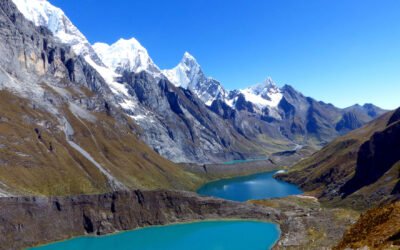
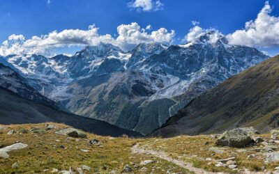
    The Cordillera Huayhuash Trek Tour in Peru is a challenging and exhilarating adventure, spanning 113 km over 8 days. This trek takes you through some of the most breathtaking landscapes in the Andes, with towering peaks, pristine glacial lakes, and remote highland villages.

    Overland Track

    Overland Track

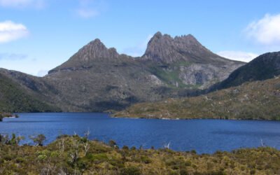
    The Overland Track in Tasmania, Australia, is a renowned 78 km trek that takes around 5 days to complete. This iconic trail weaves through the heart of the Tasmanian Wilderness World Heritage Area, offering adventurers a chance to experience some of Australia's most stunning natural beauty.

    Tongariro Northern Circuit

    Tongariro Northern Circuit

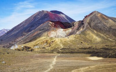
    The Tongariro Northern Circuit in New Zealand is a renowned trekking route that takes adventurers through the diverse landscapes of the Tongariro National Park. Covering a distance of 45 kilometers, this circuit typically requires 3 days to complete.

    Karhunkierros (The Bear’s Trail)

    Karhunkierros (The Bear’s Trail)

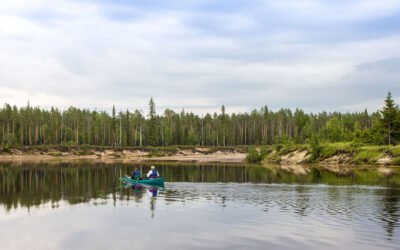
    The Karhunkierros, also known as the Bear's Trail, is a stunning trek through the pristine wilderness of Finland. Spanning 78 kilometers, this trail typically takes about 4 days to complete, making it a perfect adventure for those looking to immerse themselves in nature.

    Stubaier Höhenweg

    Stubaier Höhenweg

    The Stubaier Höhenweg in Austria is a breathtaking high-altitude trail that offers a challenging yet rewarding adventure for seasoned hikers. Covering a distance of 76 km over seven days, this trek showcases the stunning beauty of the Stubai Alps

    West Highland Way

    West Highland Way

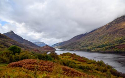
    The West Highland Way is a renowned long-distance trail in Scotland, stretching 153 km from Milngavie to Fort William. This popular route typically takes 7 days to complete, offering a diverse experience through Scotland's stunning landscapes.

    Lofoten Long Crossing Hike

    Lofoten Long Crossing Hike

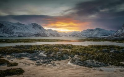
    The Lofoten Long Crossing Hike in Norway covers 180 kilometers over 11 days. Starting at Delp and ending at Brekka, the hike takes you through dramatic cliffs, serene fjords, and lush valleys.

    Laugavegur

    Laugavegur

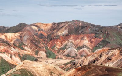
    The Laugavegur in Iceland is a stunning trek that spans 80 kilometers and typically takes about 5 days to complete. This popular route offers an array of breathtaking landscapes, from geothermal hot springs and multicolored rhyolite mountains to vast lava fields and pristine glacial rivers.

    Would you like to discover other itineraries around the world ?